
Projectspartraxx.dev
Topicapps
Date10 / 11 / 26
Sheet3 of 4
Sheet 3 · tools and apps

Apps

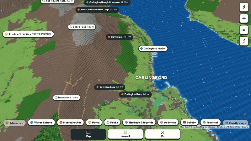
The 3D map made of blocks: a mountain with its trails and summits with their height written next to them, a coastal town and the sea
Topographic map · 3D view

Topographic map

in developmentworks with no signal

A trekking guide for your phone: a 3D map made of blocks, built from real elevation data. It installs from the browser and works with no signal, which is exactly what you're missing up on a hill.

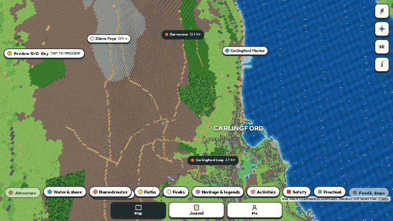
  • trails with their length and summits with their height
  • GPS, compass and the height of any point you tap
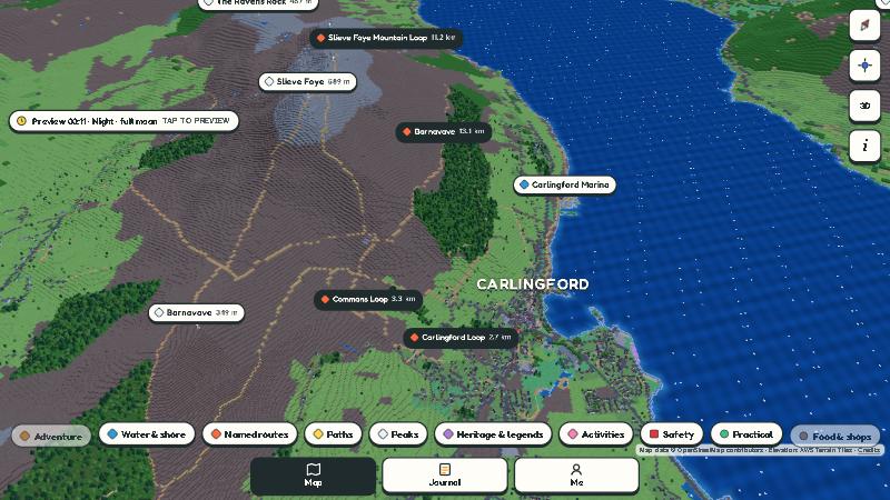
  • day and night, 3D view or from above
  • three.js, on PC, Android and iPhone

sample area: Carlingford, Ireland. Between the mountain and the sea, its terrain shows the idea really well.

The same map seen from above, with the trails marked as dotted lines
from above, with the trails
The map at night, under a full moon
at night, under a full moon

Map data © OpenStreetMap contributors · elevation: AWS Terrain Tiles

early stage

Pocket Telescope

An astrophotography camera for Android. It stacks many photos of the sky right on the phone, to bring out what a single shot can't show. The plan is for it to also track the stars as the Earth turns. There's still a lot of work to do.

Android · photo stacking · tracking on the way

barely an idea · v0.3

¿Where Is my Boss?

A boss radar for offices that looks like a video game. You build a 3D map of your office, mark where you are and report where you last saw the boss. Before you sneak off to the kitchen, a traffic light tells you if the coast is clear. That's as far as it got: an idea with a prototype.

3D map with a CRT-TV filter · Spanish, Portuguese and English
next app: